Answered step by step
Verified Expert Solution
Link Copied!

Question

1 Approved Answer

2. The following is a topographic map of a region around Sacagawea Peak in the Bridger Range (all units in feet): 5000 8800 8400 9400
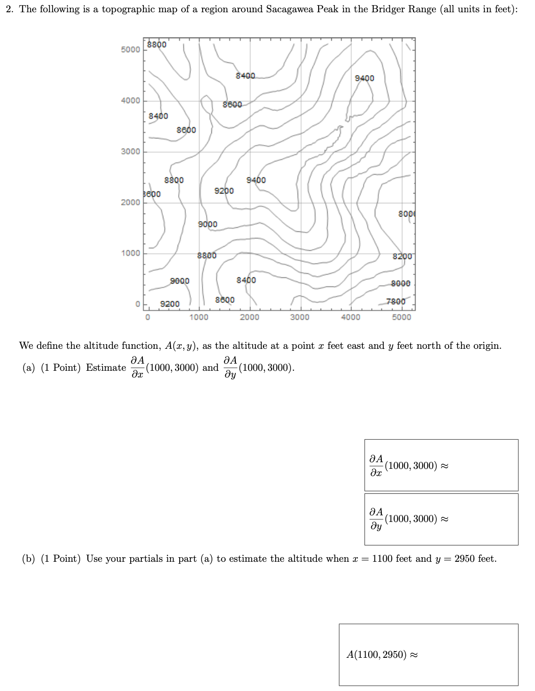
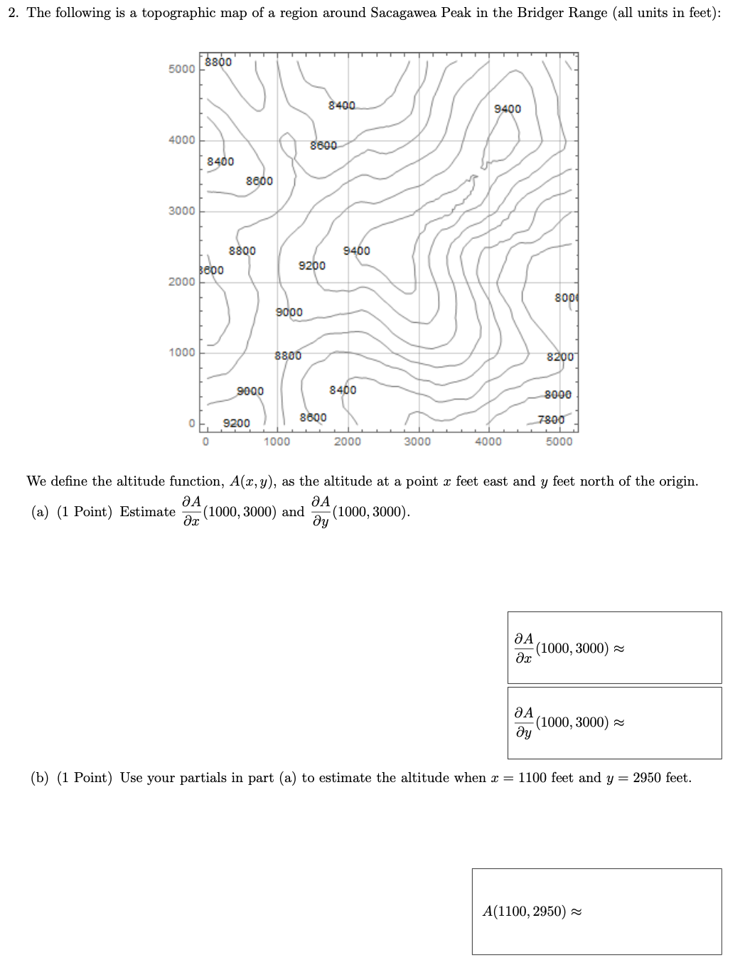
image text in transcribed
2. The following is a topographic map of a region around Sacagawea Peak in the Bridger Range (all units in feet): 5000 8800 8400 9400 1000 8600 8400 8600 3000 8800 9400 9200 2000 800 9000 1000 8800 8200 9000 8400 8000 9200 8600 7800 1000 2000 3000 4000 5000 We define the altitude function, A(x, y), as the altitude at a point r feet east and y feet north of the origin. (a) (1 Point) Estimate (1000, 3000) and (1000, 3000). (1000, 3000) ~ (1000, 3000) ~ ay (b) (1 Point) Use your partials in part (a) to estimate the altitude when x = 1100 feet and y = 2950 feet. A(1100, 2950) ~

Step by Step Solution

There are 3 Steps involved in it

Step: 1

blur-text-image

Get Instant Access to Expert-Tailored Solutions

See step-by-step solutions with expert insights and AI powered tools for academic success

Step: 2

blur-text-image

Step: 3

blur-text-image

Ace Your Homework with AI

Get the answers you need in no time with our AI-driven, step-by-step assistance

Get Started

Recommended Textbook for

Geometry A Comprehensive Course A Comprehensive Course

Authors: Dan Pedoe

1st Edition

0486131734, 9780486131733

More Books

Students also viewed these Mathematics questions

Question

Outline Aquinass methodology.

Answered: 1 week ago

Question

find all matrices A (a) A = 13 (b) A + A = 213

Answered: 1 week ago