Answered step by step
Verified Expert Solution
Link Copied!

Question

1 Approved Answer

26. Highest Elevation The following data represent the land area and highest elevation for each of the seven continents. Continent Land Area Highest Elevation (square
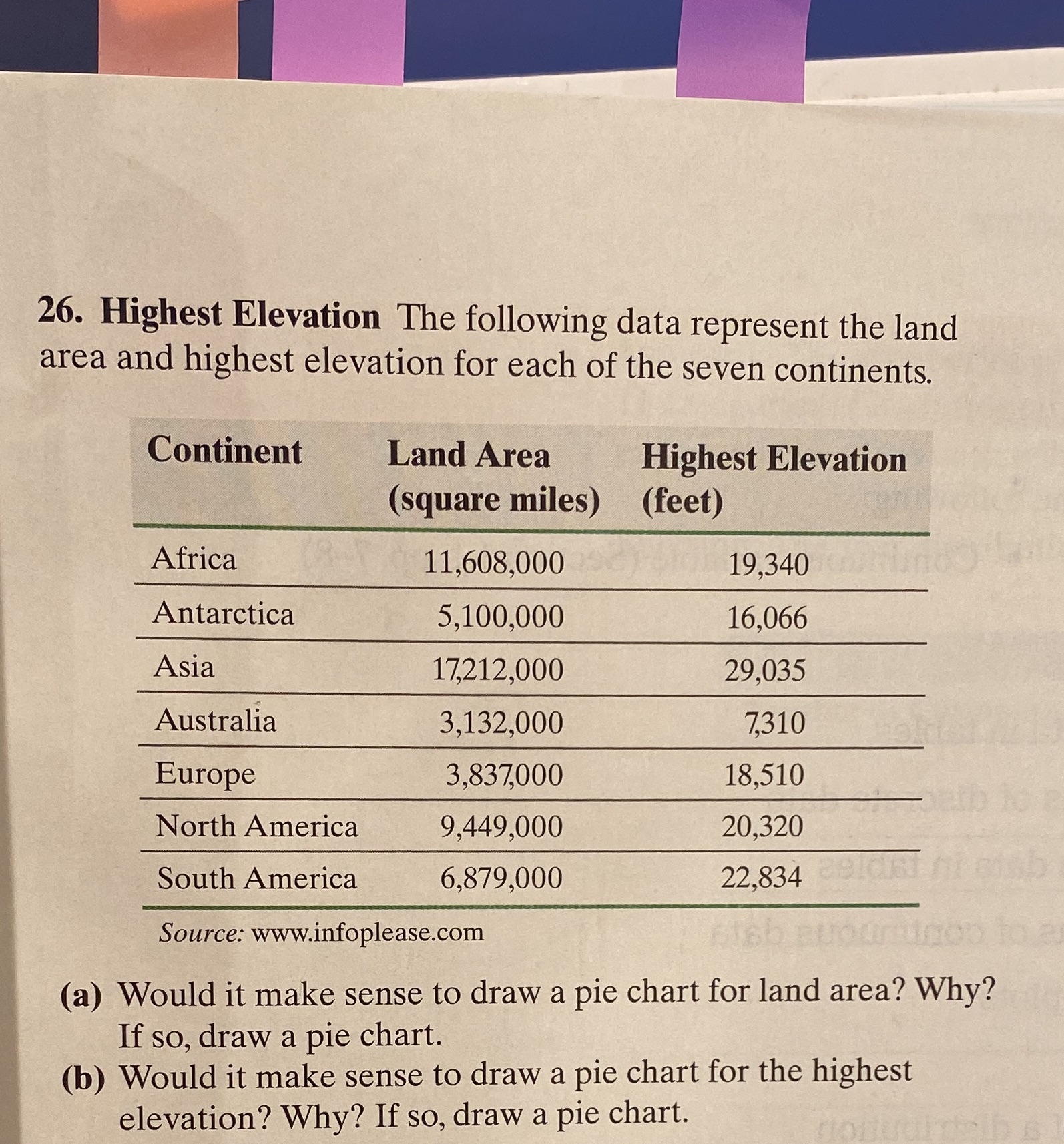
image text in transcribed
26. Highest Elevation The following data represent the land area and highest elevation for each of the seven continents. Continent Land Area Highest Elevation (square miles) (feet) Africa 11,608,000 19,340 Antarctica 5,100,000 16,066 Asia 17,212,000 29,035 Australia 3,132,000 7,310 Europe 3,837,000 18,510 North America 9,449,000 20,320 South America 6,879,000 22,834 Source: www.infoplease.com (a) Would it make sense to draw a pie chart for land area? Why? If so, draw a pie chart. (b) Would it make sense to draw a pie chart for the highest elevation? Why? If so, draw a pie chart

Step by Step Solution

There are 3 Steps involved in it

Step: 1

blur-text-image

Get Instant Access to Expert-Tailored Solutions

See step-by-step solutions with expert insights and AI powered tools for academic success

Step: 2

blur-text-image

Step: 3

blur-text-image

Ace Your Homework with AI

Get the answers you need in no time with our AI-driven, step-by-step assistance

Get Started

Recommended Textbook for

College Algebra

Authors: Cynthia Y Young

4th Edition

1119320682, 9781119320685

More Books

Students also viewed these Mathematics questions

Question

Pay him, do not wait until I sign

Answered: 1 week ago

Question

Speak clearly and distinctly with moderate energy

Answered: 1 week ago