Answered step by step
Verified Expert Solution
Question
1 Approved Answer
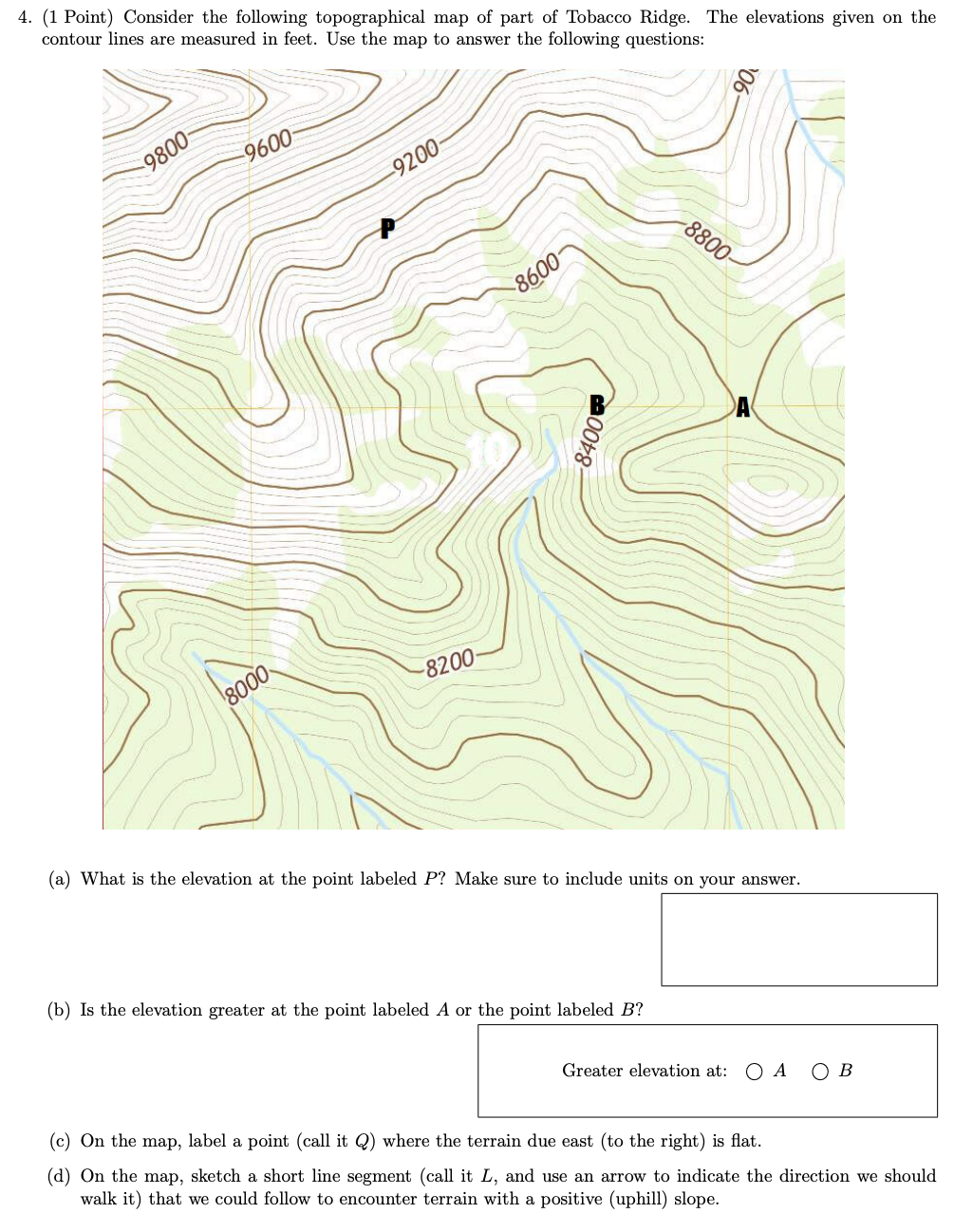
4. [1 Point) Consider the following topographical map of part of Tobacco Ridge. The elevations given on the contour lines are measured in feet. Use
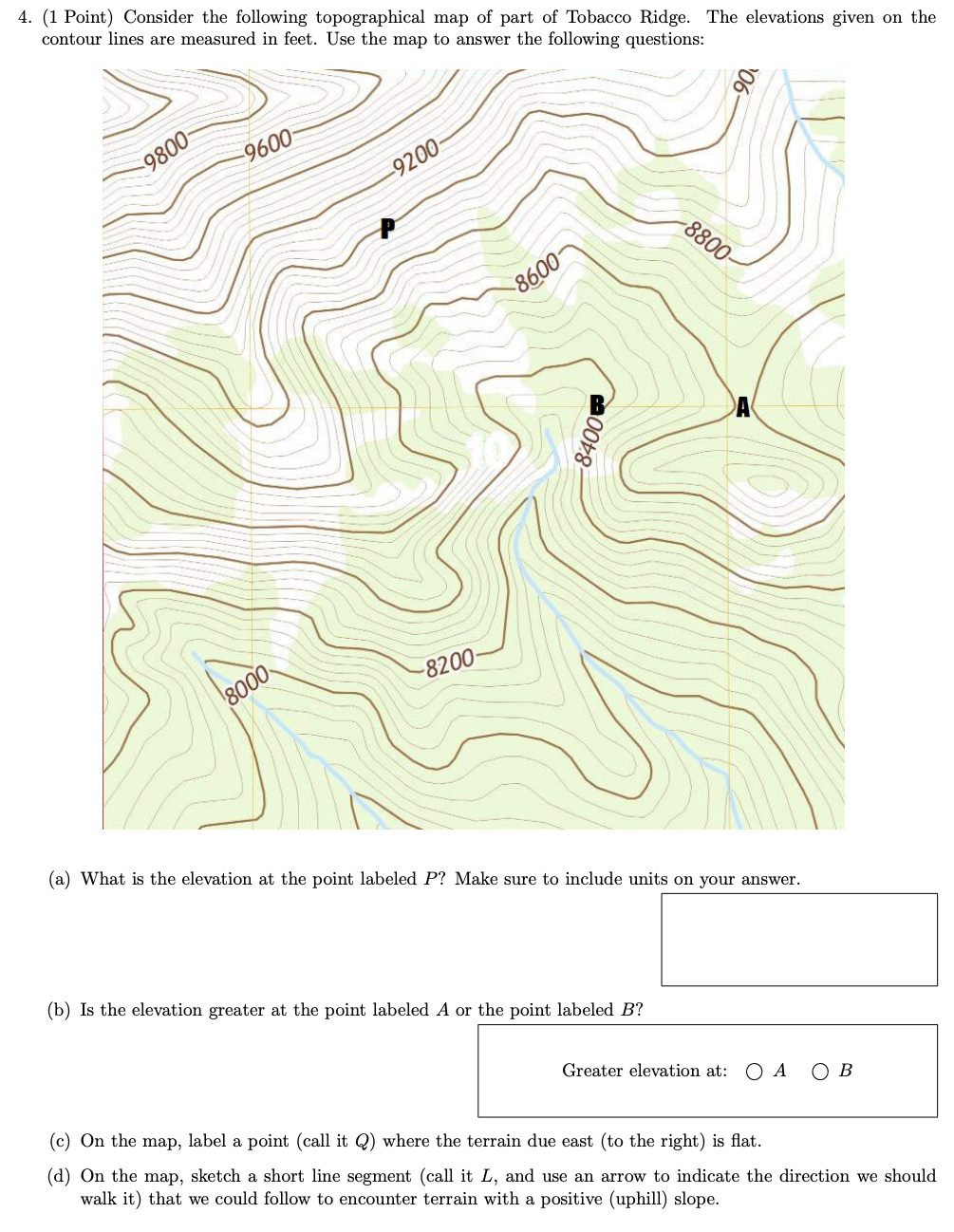
4. [1 Point) Consider the following topographical map of part of Tobacco Ridge. The elevations given on the contour lines are measured in feet. Use the map to answer the following questions: (a) What is the elevation at the point labeled P? Make sure to include units on your answer. (b) Is the elevation greater at the point labeled A or the point labeled B? Greater elevation at: O A O B (c) On the map, label a point (call it Q) where the terrain due east [to the right) is at. (d) On the map, sketch a short line segment (call it L, and use an arrow to indicate the direction we should walk it) that we could follow to encounter terrain with a positive (uphill) slope
Step by Step Solution
There are 3 Steps involved in it
Step: 1
Get Instant Access to Expert-Tailored Solutions
See step-by-step solutions with expert insights and AI powered tools for academic success
Step: 2
Step: 3
Ace Your Homework with AI
Get the answers you need in no time with our AI-driven, step-by-step assistance
Get Started