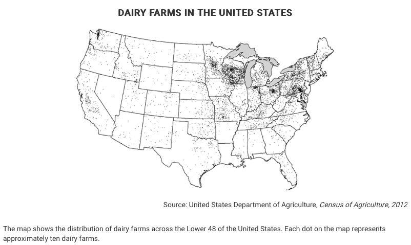
Question: A. Identify ONE type of boundary data shown on the map.B. Identify the region of the United States where most dairy farms are located.C. Identify
A. Identify ONE type of boundary data shown on the map.B. Identify the region of the United States where most dairy farms are located.C. Identify ONE spatial pattern shown on the map.D. Describe the characteristic land use associated with the spatial pattern shown on the map.E. Describe TWO geographic features not shown on the map that would help explain the patterns of dairy farming shown on the map.

DAIRY FARMS IN THE UNITED STATES I Source: United States Department of Agriculture, Census of Agriculture, 2012 The map shows the distribution of dairy farms across the Lower 48 of the United States. Each dot on the map represents approximately ten dairy farms.
Step by Step Solution
★★★★★
3.45 Rating (161 Votes )
There are 3 Steps involved in it
1 Expert Approved Answer
Step: 1 Unlock

A Identify ONE type of boundary data shown on the map The map shows state boundaries B Identify the ... View full answer

Question Has Been Solved by an Expert!
Get step-by-step solutions from verified subject matter experts
Step: 2 Unlock
Step: 3 Unlock


