Answered step by step
Verified Expert Solution
Question
1 Approved Answer
Downloading GIS data from the Web is becoming a common practice in recent years. However, when you download data from the Web, you are

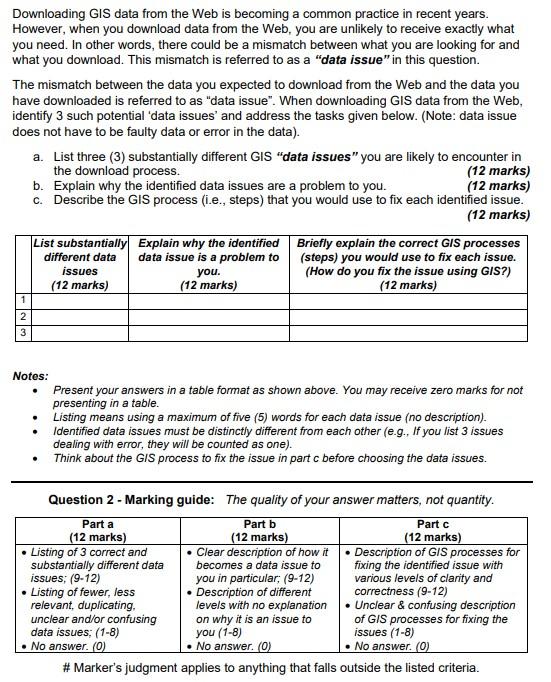
Downloading GIS data from the Web is becoming a common practice in recent years. However, when you download data from the Web, you are unlikely to receive exactly what you need. In other words, there could be a mismatch between what you are looking for and what you download. This mismatch is referred to as a "data issue" in this question. The mismatch between the data you expected to download from the Web and the data you have downloaded is referred to as "data issue". When downloading GIS data from the Web, identify 3 such potential 'data issues' and address the tasks given below. (Note: data issue does not have to be faulty data or error in the data). a. List three (3) substantially different GIS "data issues" you are likely to encounter in the download process. b. Explain why the identified data issues are a problem to you. (12 marks) (12 marks) c. Describe the GIS process (i.e., steps) that you would use to fix each identified issue. List substantially Explain why the identified data issue is a problem to you. (12 marks) different data issues (12 marks) 1 2 3 (12 marks) Briefly explain the correct GIS processes (steps) you would use to fix each issue. (How do you fix the issue using GIS?) (12 marks) Notes: . . Present your answers in a table format as shown above. You may receive zero marks for not presenting in a table. Listing means using a maximum of five (5) words for each data issue (no description). Identified data issues must be distinctly different from each other (e.g., If you list 3 issues dealing with error, they will be counted as one). Think about the GIS process to fix the issue in part c before choosing the data issues. Question 2 - Marking guide: The quality of your answer matters, not quantity. Part a (12 marks) Listing of 3 correct and substantially different data issues; (9-12) Listing of fewer, less relevant, duplicating, unclear and/or confusing data issues; (1-8) No answer. (0) Part b (12 marks) Clear description of how it becomes a data issue to you in particular; (9-12) Description of different levels with no explanation on why it is an issue to you (1-8) No answer. (0) Part c (12 marks) Description of GIS processes for fixing the identified issue with various levels of clarity and correctness (9-12) Unclear & confusing description of GIS processes for fixing the issues (1-8) No answer. (0) #Marker's judgment applies to anything that falls outside the listed criteria.
Step by Step Solution
There are 3 Steps involved in it
Step: 1

Get Instant Access to Expert-Tailored Solutions
See step-by-step solutions with expert insights and AI powered tools for academic success
Step: 2

Step: 3

Ace Your Homework with AI
Get the answers you need in no time with our AI-driven, step-by-step assistance
Get Started


