Answered step by step
Verified Expert Solution
Question
1 Approved Answer
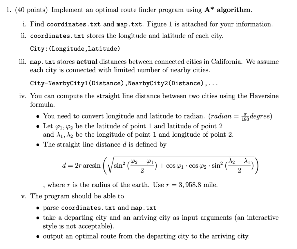
Please Solving in Python 3 1. (40 points) Implement an optimal route finder program using A* algorithm. i. Find coordinates.txt and map.txt. Figure 1 is
Please Solving in Python 3

1. (40 points) Implement an optimal route finder program using A* algorithm. i. Find coordinates.txt and map.txt. Figure 1 is attached for your information. ii. coordinates.txt stores the longitude and latitude of each city. City: (Longitude, Latitude) iii. map.txt stores actual distances between connected cities in California. We assume each city is connected with limited number of nearby cities. City-NearbyCity1(Distance), NearbyCity2(Distance),... iv. You can compute the straight line distance between two cities using the Haversine formula. You need to convert longitude and latitude to radian. (radian = 1k0 degree) Let 41, 42 be the latitude of point 1 and latitude of point 2 and 11, 12 be the longitude of point 1 and longitude of point 2. The straight line distance d is defined by d=2r arcsin (Vsin* (* (92 27.01) + cos 41 - cos p2 - sin (127'!)) 3 where r is the radius of the earth. Use r= 3,958.8 mile. v. The program should be able to parse coordinates.txt and map.txt take a departing city and an arriving city as input arguments (an interactive style is not acceptable). output an optimal route from the departing city to the arriving city
Step by Step Solution
There are 3 Steps involved in it
Step: 1

Get Instant Access to Expert-Tailored Solutions
See step-by-step solutions with expert insights and AI powered tools for academic success
Step: 2

Step: 3

Ace Your Homework with AI
Get the answers you need in no time with our AI-driven, step-by-step assistance
Get Started


