Answered step by step
Verified Expert Solution
Question
1 Approved Answer
Start with your ( ideally working ) submission of Deliverable A . Read a file of the name F [ ] b . txt .
Start with your ideally working submission of Deliverable A Read a file of the name
Fbtxt This is a file of distances between cities in which the value of each city is a floating
point number that lists either the latitude or longitude of each city.
Using the algorithm in one of the two papers on bitonic tours that I gave you, find the shortest bitonic tour
going from the highest value to the lowest value, then back to the highest value for each set of cities
The prog handout describes the format of the input file for this and all program deliverables.
As will always be the case in this class, the program must be written in Java and must run on the
University Windows computer systems. To ensure this I strongly recommend that you:
Use only Oracle Java SE and earlier constructs, and
Test it on the University systems before submission if you have any doubts about its ability to run on
the University Windows.
Submit the Java source code to the open Deliverable B submission folder. You may submit either the
source code or a full Eclipse package.
Algorithm:
The bitonic tour algorithm is described in the two bitonic tour papers uploaded under DelivB. Use
whichever algorithm you find easiest to understand theyre essentially similar and will give identical
results
Output:
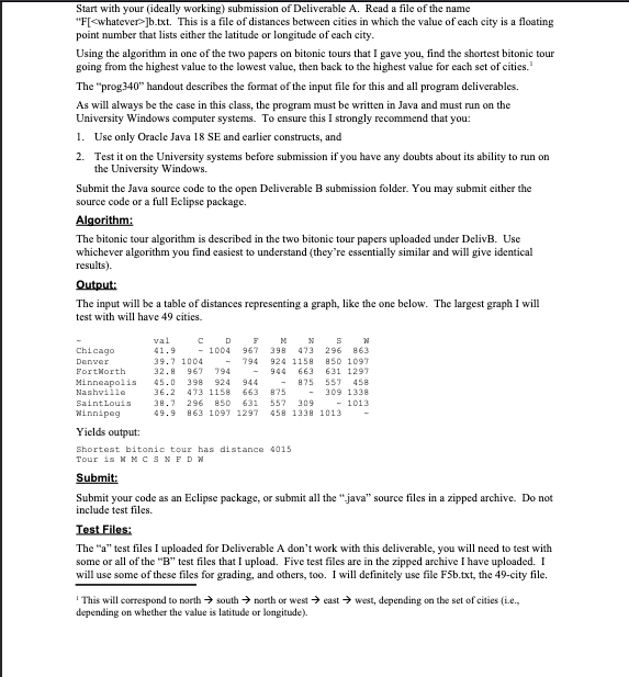
The input will be a table of distances representing a graph, like the one below. The largest graph I will
test with will have cities.
~ val C D F M N S W
Chicago ~
Denver ~
FortWorth ~
Minneapolis ~
Nashville ~
SaintLouis ~
Winnipeg ~
Yields output:
Shortest bitonic tour has distance
Tour is W M C S N F D W
Submit:
Submit your code as an Eclipse package, or submit all the java source files in a zipped archive. Do not
include test files.
Test Files:
The a test files I uploaded for Deliverable A dont work with this deliverable, you will need to test with
some or all of the B test files that I upload. Five test files are in the zipped archive I have uploaded. I
will use some of these files for grading, and others, too. I will definitely use file Fbtxt the city file.
This will correspond to north south north or west east west, depending on the set of cities ie
depending on whether the value is latitude or longitude

Step by Step Solution
There are 3 Steps involved in it
Step: 1

Get Instant Access to Expert-Tailored Solutions
See step-by-step solutions with expert insights and AI powered tools for academic success
Step: 2

Step: 3

Ace Your Homework with AI
Get the answers you need in no time with our AI-driven, step-by-step assistance
Get Started


