Answered step by step
Verified Expert Solution
Question
1 Approved Answer
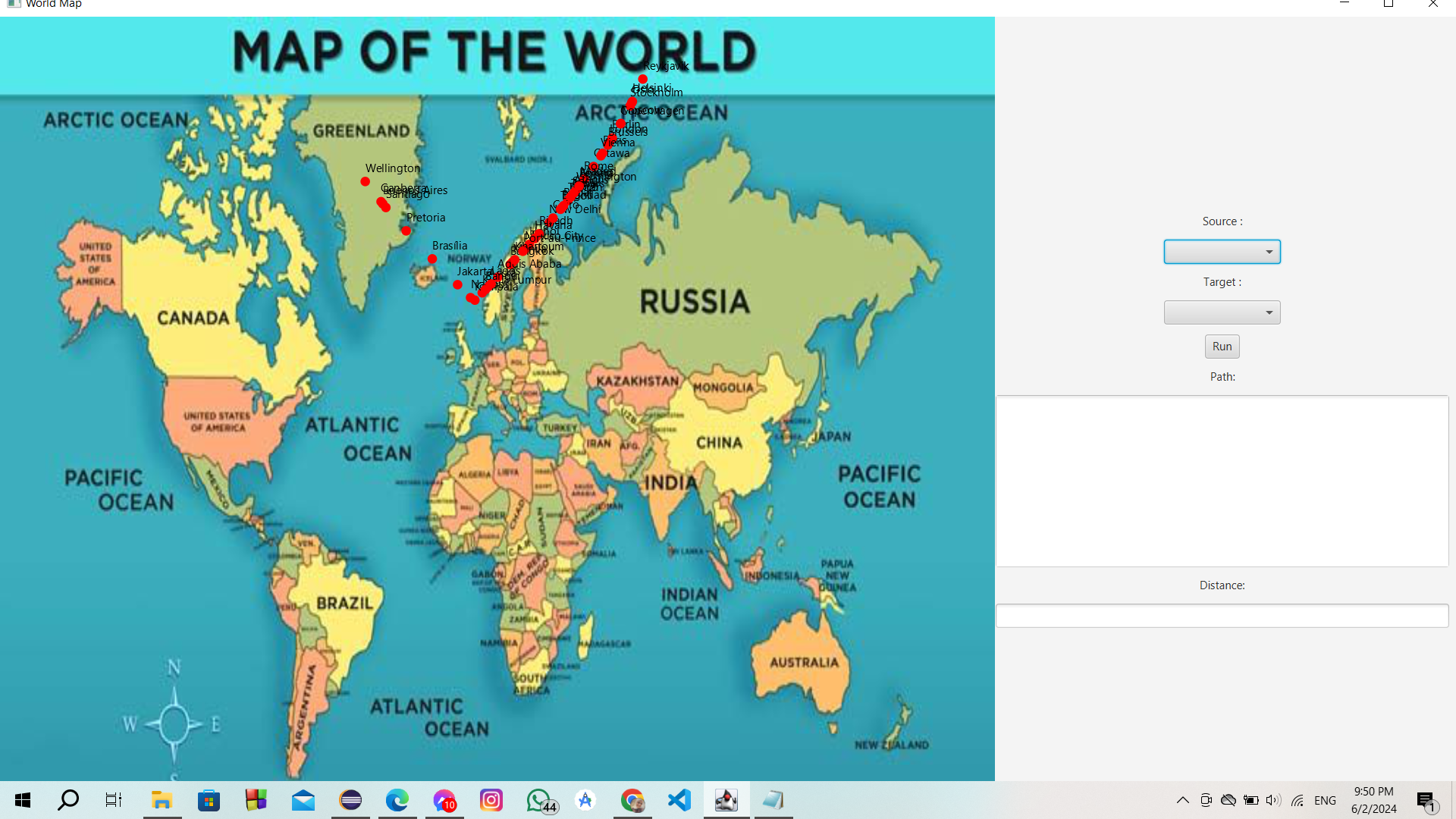
the dots on the image are supposed to be in the exact positiolatituden of the city , i gave my java code a file of
the dots on the image are supposed to be in the exact positiolatituden of the city i gave my java code a file of some cities and its longitude and latitude and i calculated x and y values from them this the code public double calculateX
Convert longitude to radians
double radLongitude Math.toRadianslongitude;
Apply Mercator projection formula
return radLongitude Math.PIMAPWIDTH Math.PI;
Method to calculate y coordinate based on latitude using Mercator projection
public double calculateY
Convert latitude to radians
double radLatitude Math.toRadianslongitude;
Apply Mercator projection formula
double mercatorY Math.logMathtanMathPI radLatitude ;
Scale and translate y coordinate to fit within map dimensions
return MAPHEIGHT MAPWIDTH mercatorY Math.PI;
fix it please

Step by Step Solution
There are 3 Steps involved in it
Step: 1

Get Instant Access to Expert-Tailored Solutions
See step-by-step solutions with expert insights and AI powered tools for academic success
Step: 2

Step: 3

Ace Your Homework with AI
Get the answers you need in no time with our AI-driven, step-by-step assistance
Get Started


