This question is posted BYMISTAKE. please DON'T ATTEMPT otherwise will give many downvote.

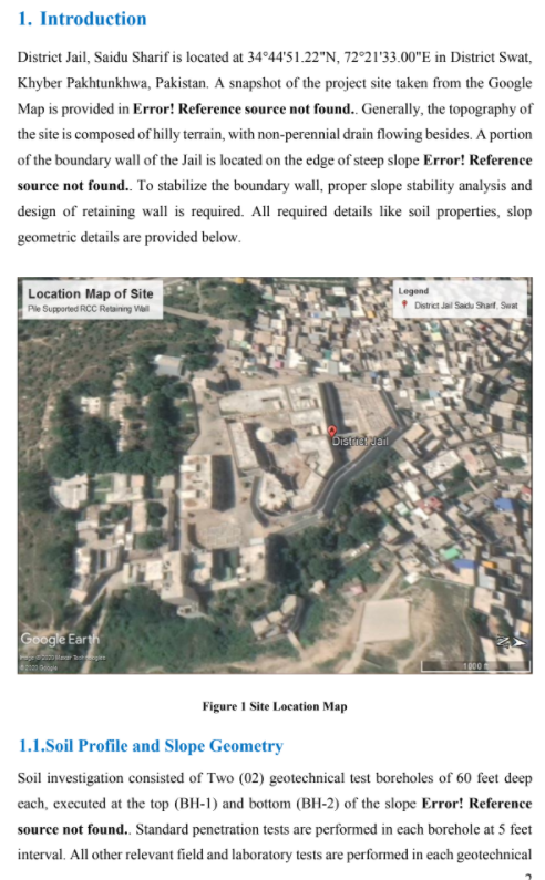
1. Introduction District Jail, Saidu Sharif is located at 3444'51.22"N, 7221'33.00"E in District Swat, Khyber Pakhtunkhwa, Pakistan. A snapshot of the project site taken from the Google Map is provided in Error! Reference source not found.. Generally, the topography of the site is composed of hilly terrain, with non-perennial drain flowing besides. A portion of the boundary wall of the Jail is located on the edge of steep slope Error! Reference source not found.. To stabilize the boundary wall, proper slope stability analysis and design of retaining wall is required. All required details like soil properties, slop geometric details are provided below. Location Map of Site Ple Supported RCC Retaining Vill Legend District Jal Saidu Sharl Swat Distadual Google Earth segi 1000 Figure 1 Site Location Map 1.1.Soil Profile and Slope Geometry Soil investigation consisted of Two (02) geotechnical test boreholes of 60 feet deep cach, executed at the top (BH-1) and bottom (BH-2) of the slope Error! Reference source not found. Standard penetration tests are performed in each borehole at 5 feet interval. All other relevant field and laboratory tests are performed in each geotechnical 1. Introduction District Jail, Saidu Sharif is located at 3444'51.22"N, 7221'33.00"E in District Swat, Khyber Pakhtunkhwa, Pakistan. A snapshot of the project site taken from the Google Map is provided in Error! Reference source not found.. Generally, the topography of the site is composed of hilly terrain, with non-perennial drain flowing besides. A portion of the boundary wall of the Jail is located on the edge of steep slope Error! Reference source not found.. To stabilize the boundary wall, proper slope stability analysis and design of retaining wall is required. All required details like soil properties, slop geometric details are provided below. Location Map of Site Ple Supported RCC Retaining Vill Legend District Jal Saidu Sharl Swat Distadual Google Earth segi 1000 Figure 1 Site Location Map 1.1.Soil Profile and Slope Geometry Soil investigation consisted of Two (02) geotechnical test boreholes of 60 feet deep cach, executed at the top (BH-1) and bottom (BH-2) of the slope Error! Reference source not found. Standard penetration tests are performed in each borehole at 5 feet interval. All other relevant field and laboratory tests are performed in each geotechnical


