Answered step by step
Verified Expert Solution
Question
1 Approved Answer
Arcgis pro assignment Background Fire Chiefs need to know the type and value of property within the different areas of their district The full domain

Arcgis pro assignment
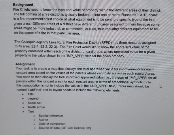
Background Fire Chiefs need to know the type and value of property within the different areas of their district The full domain of a fire district is typically broken up into one or more Runcards. A Runcard is a fire department's first choice of what equipment is to be sent to a specific type of fire ina given area. Different areas of a district have different runcards assigned to them because some areas might be more industrial, or commercial, or rural, thus requiring different equipment to be on the scene of a fire in that particular area. The Chiloquin-Agency Lake Rural Fire Protction District (RFPD) has three runcards assigned to its area (22-1, 22-2, 22-3). The Fire Chief would like to know the appraised value of the property contained within each of the district runcard areas, where appraised value for a given property is the value shown in the 'IMP APPR field for the given property Assignment Your task is to create a map that displays the total appraised value for improvements for each runcard area based on the values of the parcels whose centroids are within each runcard area. You need to then display the total improved appraised value (ie, the sum of 'IMP APPR for all parcels within the runcard area) for each runcard area in terms of proportional symbols (note this computation is not to include the values in the LND_APPR field), Your map should be named 'LabFinal' and its layout needs to include the following elements: . Title . Legend . Scale bar . North arrow Text Spatial reference o Author Date of completion Source of data (OIT GIS Service Ctr Background Fire Chiefs need to know the type and value of property within the different areas of their district The full domain of a fire district is typically broken up into one or more Runcards. A Runcard is a fire department's first choice of what equipment is to be sent to a specific type of fire ina given area. Different areas of a district have different runcards assigned to them because some areas might be more industrial, or commercial, or rural, thus requiring different equipment to be on the scene of a fire in that particular area. The Chiloquin-Agency Lake Rural Fire Protction District (RFPD) has three runcards assigned to its area (22-1, 22-2, 22-3). The Fire Chief would like to know the appraised value of the property contained within each of the district runcard areas, where appraised value for a given property is the value shown in the 'IMP APPR field for the given property Assignment Your task is to create a map that displays the total appraised value for improvements for each runcard area based on the values of the parcels whose centroids are within each runcard area. You need to then display the total improved appraised value (ie, the sum of 'IMP APPR for all parcels within the runcard area) for each runcard area in terms of proportional symbols (note this computation is not to include the values in the LND_APPR field), Your map should be named 'LabFinal' and its layout needs to include the following elements: . Title . Legend . Scale bar . North arrow Text Spatial reference o Author Date of completion Source of data (OIT GIS Service CtrStep by Step Solution
There are 3 Steps involved in it
Step: 1

Get Instant Access to Expert-Tailored Solutions
See step-by-step solutions with expert insights and AI powered tools for academic success
Step: 2

Step: 3

Ace Your Homework with AI
Get the answers you need in no time with our AI-driven, step-by-step assistance
Get Started


