Answered step by step
Verified Expert Solution
Question
1 Approved Answer
Google Earth is a powerful tool to study the Earth. Enter Google Earth into a search engine. Click on Google Earth Pro and download the
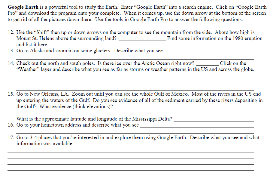
Google Earth is a powerful tool to study the Earth. Enter "Google Earth" into a search engine. Click on "Google Earth Pro" and download the program onto your complete. When it comes up, use the down arrow at the bottom of the screen to get rid of all the pictures down there. Use the tools in Google Earth Pro to answer the following questions. 12. Use the Shift" then up or down arrows on the computer to see the mountain from the side. About how high is Mount St. Helens above the surrounding land?Find some information on the 1980 eruption and list it here. 13. Go to Alaska and zoom in on some glaciers. Describe what you see 14. Check out the north and south poles. Is there ice over the Arctic Ocean right now? Click on the Weather" layer and describe what you see as far as storms or weather pattens in the US and across the globe. 15. Go to New Orleans. LA. Zoom out until you can see the whole Gulf of Mexico. Most of the rivers in the US end up entering the waters of the Gulf. Do you see evidence of all of the sediment carried by these rivers depositing in the Gulf? What evidence (think elevations)? What is the approximate latitude and longitude of the Mississippi Delta? 16. Go to your hometown address and describe what you see 17. Go to 3-4 places that you're interested in and explore them using Google Earth. Describe what you see and what information was available
Step by Step Solution
There are 3 Steps involved in it
Step: 1
Get Instant Access to Expert-Tailored Solutions
See step-by-step solutions with expert insights and AI powered tools for academic success
Step: 2
Step: 3
Ace Your Homework with AI
Get the answers you need in no time with our AI-driven, step-by-step assistance
Get Started