Answered step by step
Verified Expert Solution
Question
1 Approved Answer
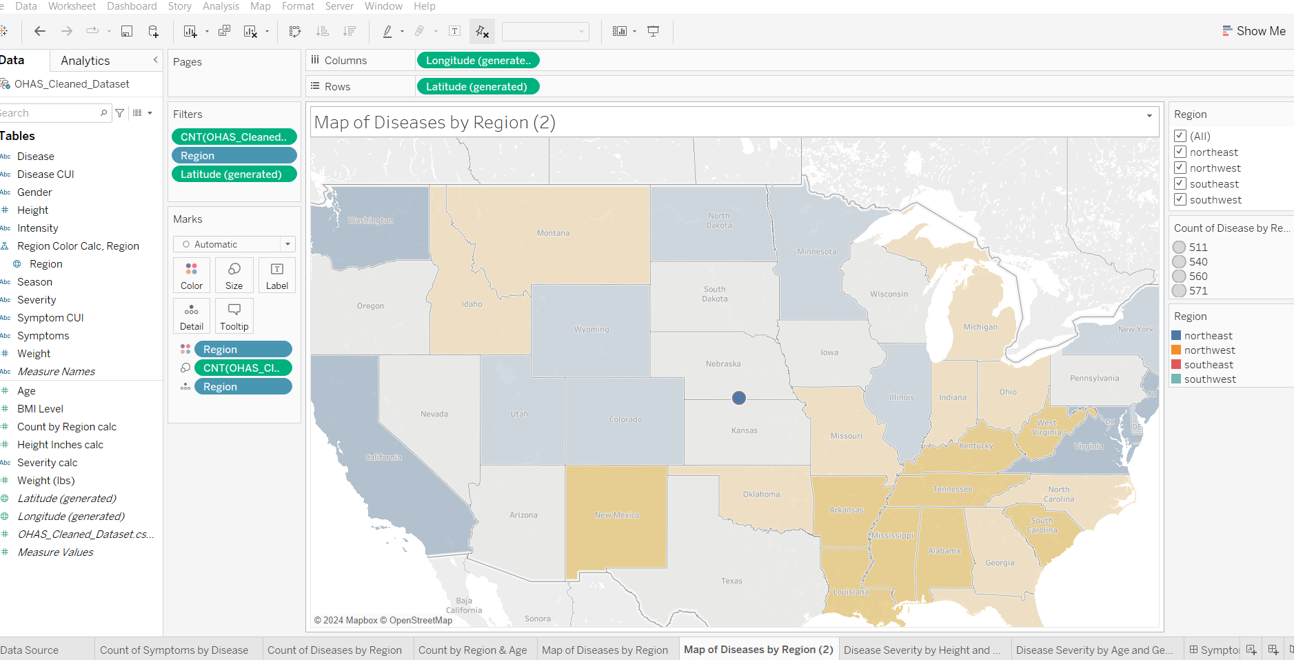
In Tableau. This map was created with latitude generated and longitude generated. I tried to create calc fields to define the 4 regions but got
In Tableau. This map was created with latitude generated and longitude generated. I tried to create calc fields to define the regions but got error operation is not permitted. I want the map to display the four regions with color identified on the legend so it sregion can display number of diseases. The prior IF statements did not work. I keep getting the error Latitude and Longitude are not defined. below is a description of the field. Longitude generated
Role: Continuous Measure
Type: Database column
Remote column: Longitude generated
Remote type: unknown
Default aggregation: Sum
Geographic Role: Longitude
Status: Valid
I cannot make generated latitude and Longitude geographic

Step by Step Solution
There are 3 Steps involved in it
Step: 1

Get Instant Access to Expert-Tailored Solutions
See step-by-step solutions with expert insights and AI powered tools for academic success
Step: 2

Step: 3

Ace Your Homework with AI
Get the answers you need in no time with our AI-driven, step-by-step assistance
Get Started


