

Answered step by step
Verified Expert Solution
Question
1 Approved Answer
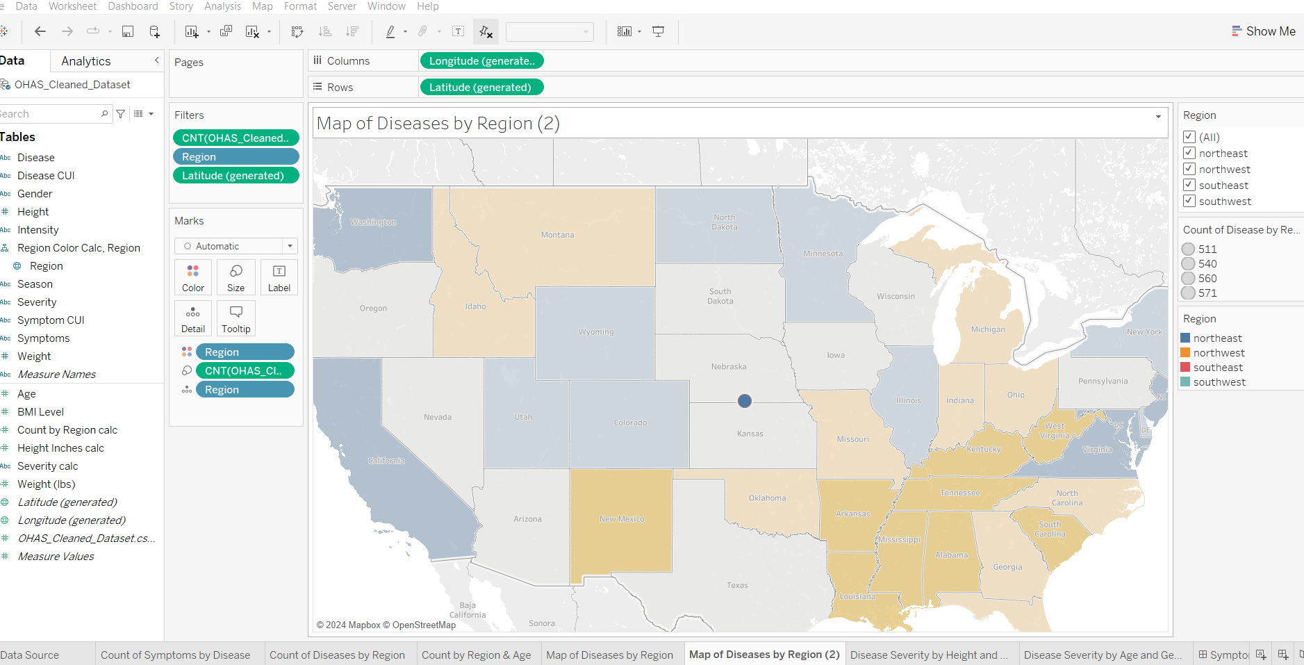
In Tableau. This map was created with latitude generated and longitude generated. I tried to create calc fields to define the 4 regions but got
In Tableau. This map was created with latitude generated and longitude generated. I tried to create calc fields to define the regions but got error operation is not permitted. I want the map to display the four regions with color identified on the legend so it sregion can display number of diseases. Because of prior answers I tried IF Latitude AND Longitude THEN "Southeast"
ELSEIF Latitude AND Longitude THEN "Northeast"
ELSEIF Latitude AND Longitude THEN "Southwest"
ELSE "Northwest"
END
But received error undefined filed Latitude and Longitude
Step by Step Solution
There are 3 Steps involved in it
Step: 1

Get Instant Access to Expert-Tailored Solutions
See step-by-step solutions with expert insights and AI powered tools for academic success
Step: 2

Step: 3
Ace Your Homework with AI
Get the answers you need in no time with our AI-driven, step-by-step assistance
Get Started
Database Driven Web Sites
Authors: Mike Morrison, Joline Morrison
1st Edition
061901556X, 978-0619015565