

Question
Question 2 Match the following GIScience terms with their descriptions: Detection of information about the surface of the earth using cameras and sensors on aircraft
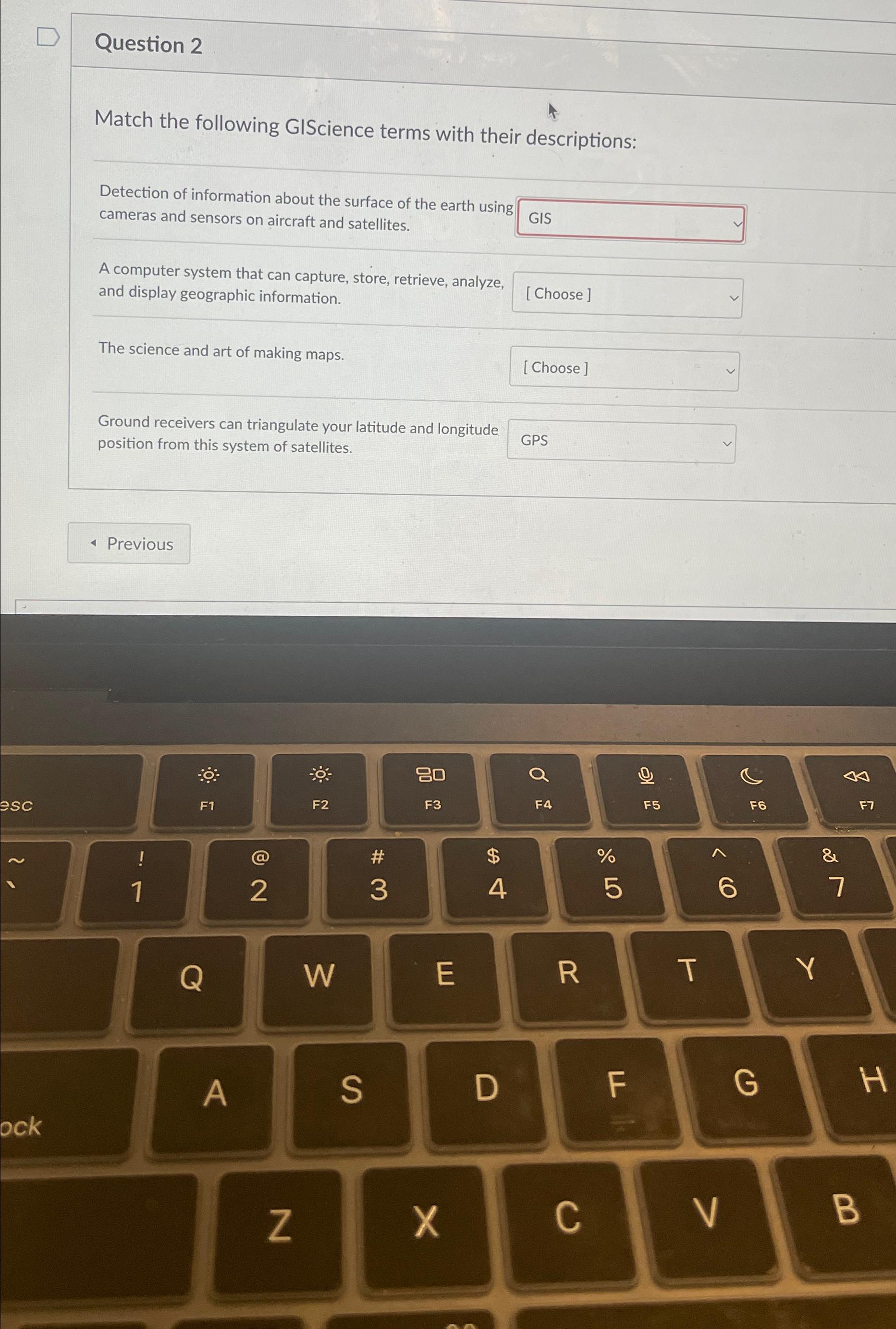
Question 2\ Match the following GIScience terms with their descriptions:\ Detection of information about the surface of the earth using cameras and sensors on aircraft and satellites.\ A computer system that can capture, store, retrieve, analyze, and display geographic information.\ The science and art of making maps.\ Ground receivers can triangulate your latitude and longitude position from this system of satellites.
Step by Step Solution
There are 3 Steps involved in it
Step: 1

Get Instant Access to Expert-Tailored Solutions
See step-by-step solutions with expert insights and AI powered tools for academic success
Step: 2

Step: 3
Ace Your Homework with AI
Get the answers you need in no time with our AI-driven, step-by-step assistance
Get Started
Modern Database Management
Authors: Jeff Hoffer, Ramesh Venkataraman, Heikki Topi
12th edition
133544613, 978-0133544619