Answered step by step
Verified Expert Solution
Question
1 Approved Answer
You have a drone that reports its position as the distance, altitude, and relative direction from the controller (you). The drone uses Cardinal Directions

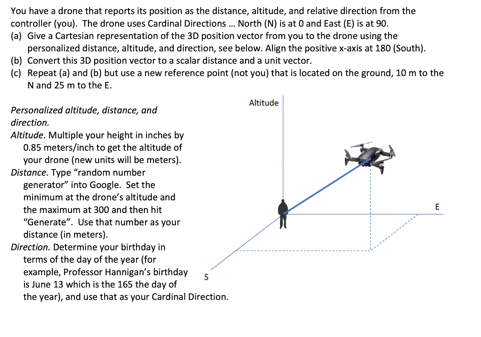
You have a drone that reports its position as the distance, altitude, and relative direction from the controller (you). The drone uses Cardinal Directions ... North (N) is at 0 and East (E) is at 90. (a) Give a Cartesian representation of the 3D position vector from you to the drone using the personalized distance, altitude, and direction, see below. Align the positive x-axis at 180 (South). (b) Convert this 3D position vector to a scalar distance and a unit vector. (c) Repeat (a) and (b) but use a new reference point (not you) that is located on the ground, 10 m to the N and 25 m to the E. Personalized altitude, distance, and direction. Altitude. Multiple your height in inches by 0.85 meters/inch to get the altitude of your drone (new units will be meters). Distance. Type "random number generator" into Google. Set the minimum at the drone's altitude and the maximum at 300 and then hit "Generate". Use that number as your distance (in meters). Direction. Determine your birthday in terms of the day of the year (for example, Professor Hannigan's birthday is June 13 which is the 165 the day of S the year), and use that as your Cardinal Direction. Altitude E
Step by Step Solution
There are 3 Steps involved in it
Step: 1

Get Instant Access to Expert-Tailored Solutions
See step-by-step solutions with expert insights and AI powered tools for academic success
Step: 2

Step: 3

Ace Your Homework with AI
Get the answers you need in no time with our AI-driven, step-by-step assistance
Get Started


