Go back

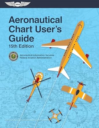
Aeronautical Chart Users Guide(15th Edition)

Authors:

Federal Aviation Administration ,U S Department Of Transportation ,Aviation Supplies Academics

Free aeronautical chart users guide 15th edition federal aviation administration ,u s department of transportation
10 ratings
Cover Type:Hardcover
Condition:Used

In Stock

Shipment time

Expected shipping within 2 Days
Access to 30 Million+ solutions Free
Ask 50 Questions from expert AI-Powered Answers
7 days-trial

Total Price:

$0

List Price: $18.95 Savings: $18.95(100%)
Access to 30 Million+ solutions
Ask 50 Questions from expert AI-Powered Answers 24/7 Tutor Help Detailed solutions for Aeronautical Chart Users Guide

Price:

$9.99

/month

Book details

ISBN: 1644252783, 978-1644252789

Book publisher: Aviation Supplies & Academics, Inc.

Get your hands on the best-selling book Aeronautical Chart Users Guide 15th Edition for free. Feed your curiosity and let your imagination soar with the best stories coming out to you without hefty price tags. Browse SolutionInn to discover a treasure trove of fiction and non-fiction books where every page leads the reader to an undiscovered world. Start your literary adventure right away and also enjoy free shipping of these complimentary books to your door.

Book Summary: Aviation Supplies & Academics, Inc. Has Been The Industry’s Trusted Source For Official FAA Publications For Over 80 Years. Look For The ASA Wings To Ensure You’re Purchasing The Latest Authentic FAA Release.The Definitive FAA Reference Source For Understanding And Interpretation Of All Aviation Charts.The Federal Aviation Administration (FAA) Publishes Aeronautical Charts For Each Stage Of Visual (VFR) And Instrument (IFR) Flight, Including Training, Planning, Departure, Enroute (low And High Altitude), Approach, And Taxiing. This Guide Is An Excellent Reference For Novice And Experienced Pilots Alike, As Well As For International Pilots Becoming Familiar With U.S. Charts. This 14th Edition Of The Aeronautical Chart User’s Guide Is The Definitive Learning Aid, Reference Document, And Introduction To The Wealth Of Information Provided On FAA Charts And In Chart Navigation Publications. Produced By The FAA’s Aeronautical Information Services Branch, It Explains All The Symbology For FAA Sectional, Terminal Area, Flyway Planning, Helicopter Route, Enroute Low- And High-altitude, And Oceanic Route Charts, As Well As Standard Terminal Arrival Routes, Standard Instrument Departures, And Instrument Approach Procedures. Also Includes Chart Legends, Airspace Classification Tables, And Is Illustrated Throughout With Full-color Graphics.