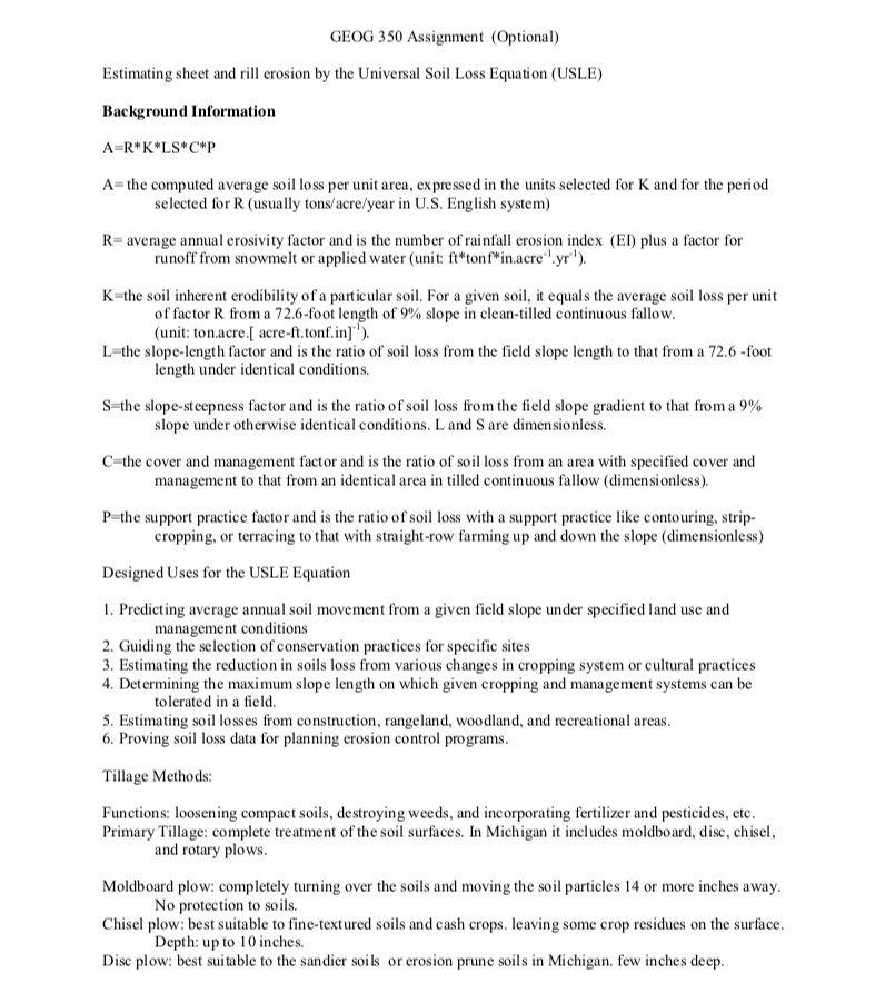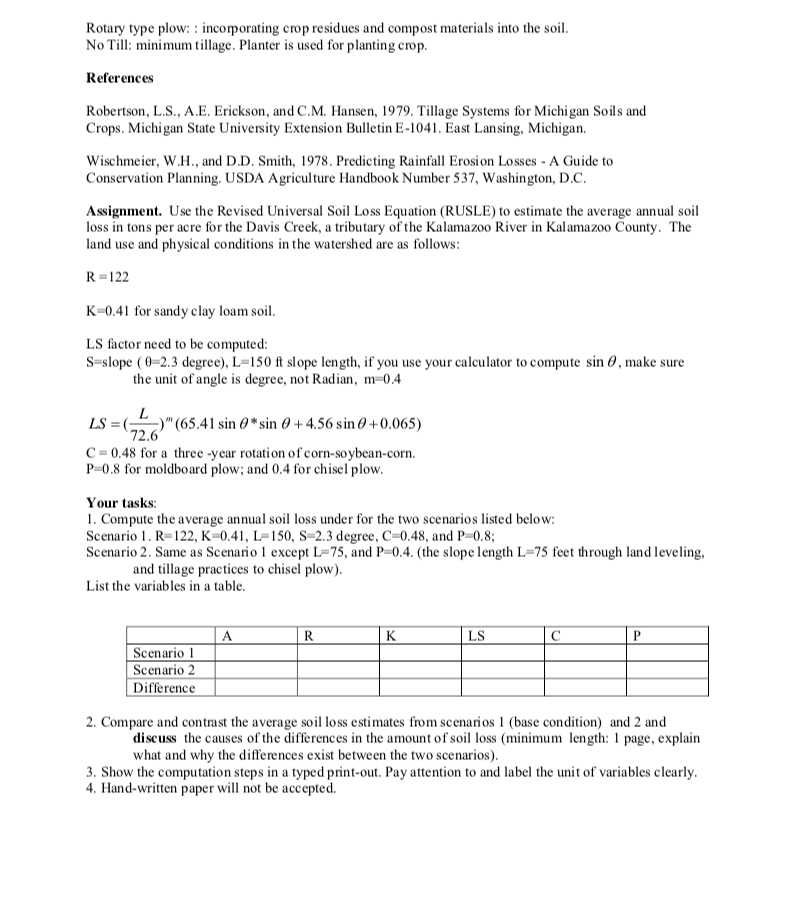

GEOG 350 Assignment (Optional) Estimating sheet and rill erosion by the Universal Soil Loss Equation (USLE) Background Information A=R*K*LS*C*P A=the computed average soil loss per unit area, expressed in the units selected for K and for the period selected for R (usually tons/acre/year in U.S. English system) R=average annual erosivity factor and is the number of rainfall erosion index (EI) plus a factor for runoff from snowmelt or applied water (unit ft*tonf*in.acre".yr). K=the soil inherent erodibility of a particular soil. For a given soil, it equals the average soil loss per unit of factor R from a 72.6-foot length of 9% slope in clean-tilled continuous fallow. (unit: ton.acre. acre-ft.tonf.in]'). L=the slope-length factor and is the ratio of soil loss from the field slope length to that from a 72.6 -foot length under identical conditions. S=the slope-steepness factor and is the ratio of soil loss from the field slope gradient to that from a 9% slope under otherwise identical conditions. L and Sare dimensionless. C=the cover and management factor and is the ratio of soil loss from an area with specified cover and management to that from an identical area in tilled continuous fallow (dimensionless). P=the support practice factor and is the ratio of soil loss with a support practice like contouring, strip- cropping, or terracing to that with straight-row farming up and down the slope (dimensionless) Designed Uses for the USLE Equation 1. Predicting average annual soil movement from a given field slope under specified land use and management conditions 2. Guiding the selection of conservation practices for specific sites 3. Estimating the reduction in soils loss from various changes in cropping system or cultural practices 4. Determining the maximum slope length on which given cropping and management systems can be tolerated in a field. 5. Estimating soil losses from construction, rangeland, woodland, and recreational areas. 6. Proving soil loss data for planning erosion control programs. Tillage Methods: Functions: loosening compact soils, destroying weeds, and incorporating fertilizer and pesticides, etc. Primary Tillage: complete treatment of the soil surfaces. In Michigan it includes moldboard, disc, chisel, and rotary plows. Moldboard plow: completely turning over the soils and moving the soil particles 14 or more inches away. No protection to soils. Chisel plow: best suitable to fine-textured soils and cash crops. leaving some crop residues on the surface. Depth: up to 10 inches. Disc plow: best suitable to the sandier soils or erosion prune soils in Michigan, few inches deep. Rotary type plow: : incorporating crop residues and compost materials into the soil. No till: minimum tillage. Planter is used for planting crop. References Robertson, L.S., A.E. Erickson, and C. M. Hansen, 1979. Tillage Systems for Michigan Soils and Crops. Michigan State University Extension Bulletin E-1041. East Lansing, Michigan. Wischmeier, W.H., and D.D. Smith, 1978. Predicting Rainfall Erosion Losses - A Guide to Conservation Planning. USDA Agriculture Handbook Number 537, Washington, D.C. Assignment. Use the Revised Universal Soil Loss Equation (RUSLE) to estimate the average annual soil loss in tons per acre for the Davis Creek, a tributary of the Kalamazoo River in Kalamazoo County. The land use and physical conditions in the watershed are as follows: R-122 K=0.41 for sandy clay loam soil. LS factor need to be computed: S-slope (02.3 degree), L=150 ft slope length, if you use your calculator to compute sin 0, make sure the unit of angle is degree, not Radian, m=0.4 LS = -) (65.41 sin o* sin 0 +4.56 sin 0+0.065) 72.6 C = 0.48 for a three-year rotation of corn-soybean-corn. P=0.8 for moldboard plow; and 0.4 for chisel plow. Your tasks: 1. Compute the average annual soil loss under for the two scenarios listed below: Scenario 1. R=122, K=0.41, L=150, S=2.3 degree, C=0.48, and P=0.8; Scenario 2. Same as Scenario 1 except L=75, and P=0.4.(the slope length L=75 feet through land leveling, and tillage practices to chisel plow). List the variables in a table. A R K LS P Scenario 1 Scenario 2 Difference 2. Compare and contrast the average soil loss estimates from scenarios 1 (base condition) and 2 and discuss the causes of the differences in the amount of soil loss (minimum length: 1 page, explain what and why the differences exist between the two scenarios). 3. Show the computation steps in a typed print-out. Pay attention to and label the unit of variables clearly. 4. Hand-written paper will not be accepted. GEOG 350 Assignment (Optional) Estimating sheet and rill erosion by the Universal Soil Loss Equation (USLE) Background Information A=R*K*LS*C*P A=the computed average soil loss per unit area, expressed in the units selected for K and for the period selected for R (usually tons/acre/year in U.S. English system) R=average annual erosivity factor and is the number of rainfall erosion index (EI) plus a factor for runoff from snowmelt or applied water (unit ft*tonf*in.acre".yr). K=the soil inherent erodibility of a particular soil. For a given soil, it equals the average soil loss per unit of factor R from a 72.6-foot length of 9% slope in clean-tilled continuous fallow. (unit: ton.acre. acre-ft.tonf.in]'). L=the slope-length factor and is the ratio of soil loss from the field slope length to that from a 72.6 -foot length under identical conditions. S=the slope-steepness factor and is the ratio of soil loss from the field slope gradient to that from a 9% slope under otherwise identical conditions. L and Sare dimensionless. C=the cover and management factor and is the ratio of soil loss from an area with specified cover and management to that from an identical area in tilled continuous fallow (dimensionless). P=the support practice factor and is the ratio of soil loss with a support practice like contouring, strip- cropping, or terracing to that with straight-row farming up and down the slope (dimensionless) Designed Uses for the USLE Equation 1. Predicting average annual soil movement from a given field slope under specified land use and management conditions 2. Guiding the selection of conservation practices for specific sites 3. Estimating the reduction in soils loss from various changes in cropping system or cultural practices 4. Determining the maximum slope length on which given cropping and management systems can be tolerated in a field. 5. Estimating soil losses from construction, rangeland, woodland, and recreational areas. 6. Proving soil loss data for planning erosion control programs. Tillage Methods: Functions: loosening compact soils, destroying weeds, and incorporating fertilizer and pesticides, etc. Primary Tillage: complete treatment of the soil surfaces. In Michigan it includes moldboard, disc, chisel, and rotary plows. Moldboard plow: completely turning over the soils and moving the soil particles 14 or more inches away. No protection to soils. Chisel plow: best suitable to fine-textured soils and cash crops. leaving some crop residues on the surface. Depth: up to 10 inches. Disc plow: best suitable to the sandier soils or erosion prune soils in Michigan, few inches deep. Rotary type plow: : incorporating crop residues and compost materials into the soil. No till: minimum tillage. Planter is used for planting crop. References Robertson, L.S., A.E. Erickson, and C. M. Hansen, 1979. Tillage Systems for Michigan Soils and Crops. Michigan State University Extension Bulletin E-1041. East Lansing, Michigan. Wischmeier, W.H., and D.D. Smith, 1978. Predicting Rainfall Erosion Losses - A Guide to Conservation Planning. USDA Agriculture Handbook Number 537, Washington, D.C. Assignment. Use the Revised Universal Soil Loss Equation (RUSLE) to estimate the average annual soil loss in tons per acre for the Davis Creek, a tributary of the Kalamazoo River in Kalamazoo County. The land use and physical conditions in the watershed are as follows: R-122 K=0.41 for sandy clay loam soil. LS factor need to be computed: S-slope (02.3 degree), L=150 ft slope length, if you use your calculator to compute sin 0, make sure the unit of angle is degree, not Radian, m=0.4 LS = -) (65.41 sin o* sin 0 +4.56 sin 0+0.065) 72.6 C = 0.48 for a three-year rotation of corn-soybean-corn. P=0.8 for moldboard plow; and 0.4 for chisel plow. Your tasks: 1. Compute the average annual soil loss under for the two scenarios listed below: Scenario 1. R=122, K=0.41, L=150, S=2.3 degree, C=0.48, and P=0.8; Scenario 2. Same as Scenario 1 except L=75, and P=0.4.(the slope length L=75 feet through land leveling, and tillage practices to chisel plow). List the variables in a table. A R K LS P Scenario 1 Scenario 2 Difference 2. Compare and contrast the average soil loss estimates from scenarios 1 (base condition) and 2 and discuss the causes of the differences in the amount of soil loss (minimum length: 1 page, explain what and why the differences exist between the two scenarios). 3. Show the computation steps in a typed print-out. Pay attention to and label the unit of variables clearly. 4. Hand-written paper will not be accepted


